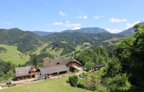
Details for: The Rudi Kefer Path
Brief description
In honor of the longtime chairman of the Opponitz tourism association, Rudi Kefer. From the old station in Opponitz to the Schluchtenhütte with a worthwhile stop.
Description
former Opponitz station - Vorderstockreith - Hinterstockreith - Schluchtenhütte (Upper Dippelreith)
Starting point of the tour
former Opponitz station
Destination point of the tour
Schluchtenhütte
Directions
B31 from Waidhofen/Ybbs to Opponitz
Parking
Parking lot Ybbstalradweg near Bruckwirt, about 200m from the hiking trail entrance
ÖBB/Rudolfsbahn to Waidhofen/Ybbs, VOR bus line to Opponitz
Author's tip
Add the Opponitz gorge hiking trail to the route.


