Details for: Village circular route "belebt.bewegt" in the hiking village Göstling/Ybbs
Brief description
Scenic circular hike from and to the hiking start point Göstling via Kalvarienberg, Marienweg and Parkbad
Description
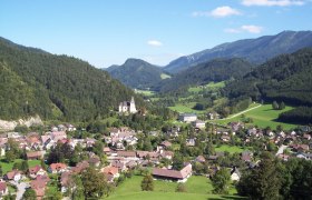
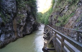
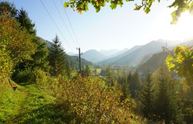
The route starts at the central hiking start point of the hiking village Göstling/Ybbs. The route leads from the town over a wooden bridge across the Ybbs to Dr. Stephan Park, where some large and old trees can be admired. In summer, the Parkbad offers the opportunity to cool off in the crystal-clear Ybbs. Passing the Ybbstaler Solebad, the route continues over another bridge across the Ybbs to the Marienweg. After a short climb, the forest especially in autumn shows an impressive play of colors. The Marienweg is located slightly elevated above the hiking village Göstling an der Ybbs and thus offers numerous impressive views of the hiking village and the surrounding mountain scenery. Following the route, you cross another wooden bridge over the Göstlingbach to the ascent of Kalvarienberg. When you reach the top, you are rewarded with a panoramic view over the hiking village Göstling an der Ybbs and the surrounding mountains. On the way back towards the town center, several historically significant houses are passed before you return to the starting point.
Starting point of the tour
Municipal office and hiking start point hiking village Göstling/Ybbs
Destination point of the tour
Municipal office and hiking start point hiking village Göstling/Ybbs
Directions
Coming from Vienna: A1 to the Ybbs exit, then via B25 to Göstling an der Ybbs
Coming from Salzburg: A1 to the Amstetten-West exit, then via B121 towards Waidhofen an der Ybbs, from there continue on L31 to Göstling an der Ybbs
Parking
Parking available at the municipal office of the hiking village Göstling/Ybbs.
Author's tip
⛰️ TIP: SHORT VACATION IN THE MOSTVIERTEL ⛰️
To get to know the hiking village Hollenstein/Ybbs, a short vacation is recommended. We are happy to assist you with booking:
info@mostviertel.at
+43 7482 204 44
