Details for: From Opponitz to the Alpl and the Schneekogel
Brief description
Summit assault from the Lucken in Opponitz over the alpine pasture of the Bauernboden to the Alpl and back over the summit of the Schneekogel.
Description
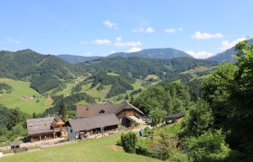
From the town center in Opponitz, walk along Strubb street to the farmhouse Lucken. There the hiking trail to Bauernboden begins. Past the Buchberg farmhouse, continue on a forest road until you switch to a hunter's path. Through partially steeper terrain, you climb through the beautiful mixed forest to the alpine pasture near the Annahütte. The route continues over the alpine meadows – like from a picture postcard – and through the forest to the highest point of the hike, the Alpl at 1405m above sea level. On the way back from the Annahütte, you also take the second summit, the Schneekogel, which also offers a great view towards the Gesäuse mountains, and then return to Opponitz.
Starting point of the tour
Opponitz town center
Directions
B31 from Waidhofen to Opponitz
Parking
Opponitz town center or Ybbstalradweg parking lot
ÖBB/Rudolfsbahn to Waidhofen/Ybbs, then VOR bus line to Opponitz
Author's tip
After the hike, refresh yourself at and in the Ybbs!


