Description
Your path leads along the shore of the Lunzer See, dotted with natural treasures. The shallow bays transform reeds and water lilies into a magnificent water garden. Dragonflies, true masters of aerial acrobatics, dart around and their quiet wingbeats mix with the rustling of wind-stirred reed stems. Shortly after Schloss Seehof, a forest path quickly leads upwards.
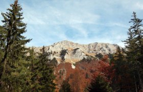
Under your feet, you feel the soft moss and leaf litter before reaching a meadow again. After crossing it, you pass a farm – now it is not far to the highest point of the viewing mountain, as soon you reach the panoramic summit Maiszinken (1075m). The summit victory is rewarded with a fabulous deep view down onto the Lunzer See sparkling in the sunlight. The descent to the Rehbergalm past the alpine guesthouse leads you further over the forest ridge of the Steinbauer mountain and surprises again and again with wonderful viewpoints.
Starting point of the tour
Seeplatz
Destination point of the tour
Seeplatz
Route description Panoramic summit Maiszinken - alpine experience included
We start from the hiking starting point at the Seeplatz and pass the boat rental and the WasserCluster,
along the lakeside path to Schloss Seehof. Here we branch off to hiking trail 06 towards Durchlass and shortly before turn left (hiking trail 21). We pass the "Moaser-Bauer" (No. 4) and ascend to the Maiszinken. We then return the same way down to the Rehbergalm. From the alpine guesthouse "Rehberg" (847m), we hike down over about 2 hours on the ridge between Lunzer See and Hinterleiten back to the starting point.
Trail markings 1,6,21,4,19 and 20
Directions
By car: A1 exit Ybbs, at the roundabout take B25 towards Wieselburg, always follow B25 towards Gaming (you will pass through Purgstall and Scheibbs). Pass the Kartause Gaming and follow the B25 over the Grubberg, after descending finally turn left towards Lunz am See (3293)
Parking
Paid parking spaces are available at the lake parking lot Lunz am See.
Take the Westbahn to Pöchlarn, where you change to the Erlauftalbahn and travel to the terminus Scheibbs. From there, you can take the regularly running buses of the Mostviertel Line to Lunz am See. The dense bus network is also available via Waidhofen/Ybbs.
ÖBB timetable (trains and buses):
http://fahrplan.oebb.at
New: Mostviertel bus line:
http://www.mostviertel-linie.at
From Kienberg, the Ötscherland-Express also runs several times a year, bringing you on the beautiful mountain railway to Lunz am See.
More information about the Ötscherland-Express:
https://www.lokalbahnen.at/bergstrecke/


