Details for: Hochmoor Leckermoos (Moorweg)
Brief description
The adventure trail around the Leckermoos
Description
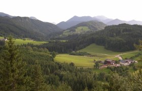
The 25-hectare Leckermoos nature reserve is located in a high valley floor. The high moor, which had suffered greatly from major encroachments in the past, was renaturalized between 2004 and 2006.
A moorland trail around the wetland was opened to visitors in 2006. 11 stations and information boards provide interesting facts about the formation of the high moor, its use in the past and the diverse, rare biocoenoses. The nature trail is also specially designed to meet the needs of children. At the end of the footbridge, you will find a book-shaped moor encyclopaedia that explains the special features of a moor and its vulnerability. The "Wheel of Diversity" also invites you to join in. Here you will be introduced to the habitats of the Leckermoor.
Please keep to the path rules and do not leave the paths to protect the moor. If you have a dog with you, please keep it on a lead.
Starting point of the tour
Leckermoor Parking Lot
Route description Hochmoor Leckermoos (Moorweg)
It's best to follow the signposted and easily recognizable loop trail in a counterclockwise direction.
Directions
From 3345 Göstling an der Ybbs, drive about 6 km to the end of Hochreit Street. Follow the signs for Leckermoos. The road is narrow with passing lanes and has a gradient of up to 15%. After 4 km, you’ll reach the Ablass snack bar (= Information Center and lowland bog), from where the road continues for another 2 km or leads to a 40-minute hike to the starting point of the Moorweg trail.
Author's tip
The dark lake in the center of the bog, known as the “Moorauge,” can be reached via a wooden walkway.