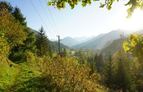
Hochkar route

Mountainbike route from Göstling, info to Hochkar, Geischlägerhaus

To view this content, you need to accept our Cookies. Change Cookie Settings
Full screen mode
Elevation profile

38,64 km length

Tour dates
  • Difficulty: Difficult
  • Route: 38,64 km
  • Ascent: 1.240 egm
  • Descent: 1.240 egm
  • Duration: 2:30 h
  • Lowest point: 529 m
  • Highest point:1.769 m
Features
  • Tour route
  • Nice views
  • With refreshment stops
  • Summit tour

Details for: Hochkar route

Brief description

Very demanding ascent with gradients up to 28% to the ski and hiking area at Hochkar. 

Description

Göstling - Lassing - Hochkar Alpenstraße - Hochkar valley floor - Geischlägerhaus - Hochkar valley floor  - Lassing - Göstling

Starting point of the tour

Göstling, info

Destination point of the tour

Hochkar, Geischlägerhaus

Directions

Coming from Vienna, take the A1 to the Ybbs exit, then B25 to Göstling.

Coming from the west, take the A1 to the Oed exit, via Aschbach Markt on B121, then continue to Waidhofen an der Ybbs, at Waidhofen take B31, continue on B31 to Göstling.

Equipment

MTB or trekking bike with easy gearing. 

Safety information

Please note the winter closure of this and all other MTB routes in Mostviertel from November 1 to April 14. 

Thank you for your understanding!


Map recommendations

MTB map Mostviertel, available at the tourist office

Author's tip

Extend your stay at Hochkar and take a short hike to the Skytour. 
 

More tours around the starting point