Description
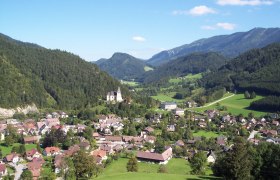
Göstling is one of the most traditional holiday resorts in Lower Austria. It is located in the tri-border area of Lower Austria-Styria-Upper Austria. The beautiful alpine regions offer opportunities for hikes to numerous managed huts. Göstling stands for relaxation, sport, and fresh air.
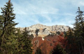
The rustic limestone peak “Dürrenstein” is part of the "Dürrenstein Wilderness Area" and, besides its karst formations and sinkholes, has a rich alpine flora and fauna. The ascent is long and arduous, but the view from the summit cross compensates for the effort.
Even without the "summit victory," it is especially attractive: you just need to let the dreamlike landscape affect you.
Starting point of the tour
Parking lot in Steinbachtal
Destination point of the tour
Parking lot in Steinbachtal
Route description From Steinbachtal to the Ybbstalerhütte and the Goldaugraben
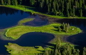
From the parking lot, walk a short distance uphill on the forest road and turn right onto the steeper forest path. The path leads through the alpine forest up to the hunting hut at the Dürreck junction. Here, the forest path crosses a forest road. Shortly thereafter, there is a small spring on the right side of the path. Then continue until the forest path merges into a flat forest road, where about 600 m to the left leads to the Bärenlacke.
At the next fork, go uphill to the right - soon after, you reach the Höll. Go through the alpine gate continuing to the forest road, along the forest road or the parallel path to the Ybbstalerhütte (1343 m above sea level).
From the Ybbstalerhütte, there are different connection options:
1. Noten (1640 m above sea level), walking time: about 1 hour to the summit
2. Dürrenstein summit (1878 m above sea level), walking time: about 2 hours to the summit (see Lunzer Dürrenstein route 7)
Refreshed and strengthened, the path leads back to the fork where a signpost points to Stiegengraben. Follow this steep path downhill to the end of a forest road, where there is a small hunting hut and a former gravel pit. Walk about 100 m on the road and cross a stream until a signpost points left down into the Goldaugräben. Following the signpost, immediately cross the small stream again. Shortly after, there is a somewhat larger stream, the Hagenbach, which you cross on a footbridge made of tree trunks. From now on, walk a short uphill section. Then go downhill along the Goldaugraben, under an aqueduct, to the settlement of Hagenbach. Now continue along the asphalt road through the settlement until the junction with the main valley. Immediately after the junction, cross two bridges and then turn left onto the forest road, which is also used as a cycling, hiking, and theme trail "The Power of Water." After about 1 km, at a hairpin bend, keep left and descend after a climb into the "Not" (562 m above sea level). After a short climb, turn right on the asphalt road back to the starting point.
Since the last part of the route runs on asphalt, it is recommended to park a car in Hagenbach and return by it.
Directions
coming from Linz: A1 exit Oed - direction Aschbach Markt - continue on B121 to Waidhofen - in Waidhofen/Ybbs take B31 direction Göstling/Ybbs
coming from Vienna: A1 exit Ybbs/Donau - direction Eisenstraße - follow B25 to Göstling/Ybbs
Parking
Parking lot at the fish ponds in Steinbachtal

