Haute Route 11. Etappe: Göstling – Hollenstein

Trekking trail from Göstling to Hollenstein

To view this content, you need to accept our Cookies. Change Cookie Settings
Full screen mode
Elevation profile

21,95 km length

Tour dates
  • Difficulty: Difficult
  • Route: 21,95 km
  • Ascent: 977 egm
  • Descent: 1.050 egm
  • Duration: 5:30 h
  • Lowest point: 459 m
  • Highest point:1.435 m

Details for: Haute Route 11. Etappe: Göstling – Hollenstein

Starting point of the tour

Göstling

Destination point of the tour

Hollenstein

Route description Haute Route 11. Etappe: Göstling – Hollenstein

Königsberg Crossing

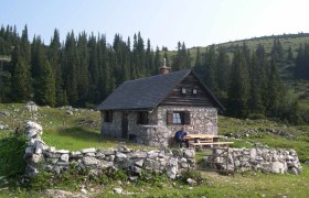
Route: Göstling – Bromreit (or Saggraben Waterfall – Scheitergraben) – Kurzeck – Siebenhütten – Königsberg (Vierhütten, 1,400 m) – Kitzhütte – Hochschlag – Grenzberg (Naturfreundesteig Trail) – Hollenstein on the Ybbs (497 m; take the Ybbstalbahn to Waidhofen on the Ybbs, with a connection to the Westbahn).

Map recommendations

Freytag & Berndt WK 051

More tours around the starting point