Description
From the Hochkar ski area, which you leave via the mountain lake on narrow, beautiful alpine hiking trails, the route initially runs along the ridge to the Ringkogel. Time and again you can look towards the Dürrenstein wilderness area; the summit of the mountain that gives it its name is also very close. After the Ringkogel, a few hundred meters descend to the Schwarzalm, where you will have covered about half the distance and can take a perfect rest.
The route continues through the most beautiful alpine and meadow nature to a narrow path downhill (careful, do not slip!), from where you can already enjoy a very beautiful view over the raised bog. Once at the bottom, the last meters lead along the Leckermoor circular trail, which features eleven stations with highly interesting facts about the nature reserve in the Göstling district of Hochreit.
Starting point of the tour
Hochkar, valley station
Destination point of the tour
Göstling-Hochreit, Leckermoor
Route description Hochkar - Ringkogel - Schwarzalm - Hochreit
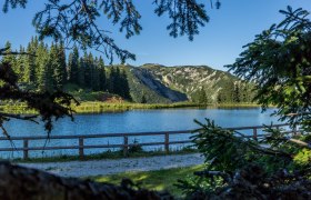
From the Hochkar shelter, a gravel road leads moderately steeply up to the Blachlboden, where an artificial mountain lake was created in 1998 at the foot of the Scheiterkogel.
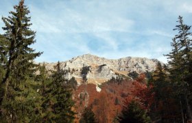
Looking back towards the Hochkar ski area, Stumpfmauer and Gamsstein appear in the west and above the Scheinecksattel the Haller Mauern. The striking reddish rock, which consists of impermeable Lias limestone, causes small ponds and streams, especially for the lush flora. From Blachlboden, the now narrow drive crosses horizontally under small rock faces to the east to the wide karst hollow of the Schrottleitneralm. Diagonally left, a path leads up a meadow strip in several hairpin bends to a flat saddle north of the "Schmalzmauer." From the saddle, a path branches right through a gate, the "Teufl R.-Steig," with small hairpin bends, descending a bit in the direction of "Seelucken," then crossing the scree fields under rock faces to the right at half slope height, finally gently ascending on grass bands between spruce trees again out of the steep terrain to continue the main ridge. Very scenic over some grassy knolls to a meadow saddle immediately before the narrow, dwarf-pine-covered ridge edge of the "Geißhöhe." The path immediately turns diagonally left up into the north ridge of the Geißhöhe and finally crosses just below the summit ridge through dwarf pine alleys the steep, densely vegetated northern slope. On the east ridge, small forest clearings open again between old spruce trees that lead down to a flat meadow floor. Then you cross the stone-strewn mountain meadows of the "Munsinplanes," keeping more to the right near the south-facing cliffs along fence remnants, descend briefly through a hollow characterized by rock fissures and boulders and finally reach at the "Planstiege" the forest saddle immediately before the rise of the Ringkogel.
Here a path branches left to Schwarzalm.
Directly from the Schwarzalm hut, the path ascends right over a free meadow ridge to a junction. Then it goes left down into the highly interesting, peculiar karst landscape of the "Kessel" (very confusing terrain!). The path ends on a hill from which you reach the Wiesenalm hut at 1,486 m above sea level across flowery meadows.
The Wiesenalm is the most remote and scenically most beautifully situated alpine pasture of the Hochkar massif. To the southwest lies the already mentioned huge karst area of the "Kessel" with enormous dolines, limestone pavements, and karst alleys. About 300 m northwest from the hut is a wooded mountain peak from which the Betmauer drops steeply to the north (magnificent view down to the Leckermoor). At the western base of the cliff lies the legendary Freyndllucke. From the hut, left through mighty spruce trees. Then you follow the moderately steep mountain ridge down over a broad, flowery meadow ridge with views of the Dürrenstein. The path turns left downhill through sparse forest over the small mountain saddle of Hocheck to a gate. Then on a path with many small hairpin bends downhill through a light coniferous forest to a forest road that leads directly to the Leckermoor. From the raised bog, an asphalt road leads past many beautiful farms of the Hochplateau Hochreit to Göstling.
