Details for: Höhenstein route
Brief description
Beautiful route rewarded with magnificent views of the surrounding mountain landscape!
Description
The actual "Höhenstein route" has been well marked with red signs for several years.
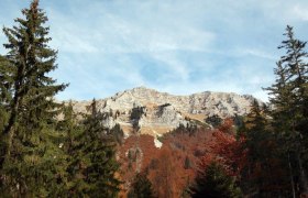
It is a relatively short and easy but very varied and therefore rewarding route. Although no single spot offers a panoramic view all around, the path passes many beautiful viewpoints that naturally invite stops and photos.
From the parking lot, follow the marked forest path uphill for about 35 minutes until you reach the ridge (bench; panoramic view of Ötscher, Scheiblingstein & Co). Then follow the ridge until you reach the highest point of the hike (wooden cross at Egger Berg 1,134 m). From here, it goes gently downhill to Höhensteineck. From there, go down through the forest to the Höhensteinstube house, where you follow the asphalt road back to the starting point.
Starting point of the tour
Windhag or Höhenstein
Destination point of the tour
Egger Berg
Directions
By car: from Linz, Salzburg, Munich or Vienna via the A1 to exit Ybbs an der Donau – then via B25 to Lunz am See
Parking
Parking is available at the dilapidated farmstead Windhag and at the Höhensteinstube house.
By train to Scheibbs or Waidhofen an der Ybbs and from there by bus to Lunz am See
Author's tip
This route is especially recommended in autumn!


