Opponitz - Schneekogel - Kleinhollenstein

Hiking route from Ortszentrum Opponitz to Klein-Hollenstein

To view this content, you need to accept our Cookies. Change Cookie Settings
Full screen mode
Elevation profile

16,21 km length

Tour dates
  • Difficulty: Medium
  • Route: 16,21 km
  • Ascent: 1.002 egm
  • Descent: 981 egm
  • Duration: 5:00 h
  • Lowest point: 419 m
  • Highest point:1.373 m
Features
  • Summit tour

Details for: Opponitz - Schneekogel - Kleinhollenstein

Brief description

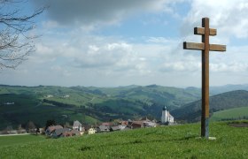
From the fishing village of Opponitz to Kleinhollenstein. In the middle the Schneekogel. Lots of forest, lots of peace, lots of enjoyment.

Starting point of the tour

Ortszentrum Opponitz

Destination point of the tour

Klein-Hollenstein

Map recommendations

Wanderkarte Ybbstaler Alpen, erhältlich im Tourismusbüro

More tours around the starting point