Details for: RW3
Brief description
Beautiful but long circular route with great dining opportunity at the Kitzhütte
Description
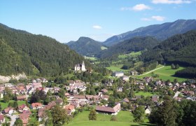
From the village square in Hollenstein initially to Bauerhaus Hochschlag and on the partly steep alpine path to the Kitzhütte (operated from May to October). Past it, the path leads down on the forest road to Eisgrabensattel. Here a forest road branches off to the right, running high above the Sandgraben valley outwards. After about 2 km a hunting trail begins where sure-footedness is partly required, leading out to the beautifully situated mountain meadow of Hochau. Following the marking, past the former Hof Hochscheuch, the path merges again into Königsbergstraße at Sattelreith, and on this it goes about 400m uphill back to the starting point.
Starting point of the tour
Hollenstein: Village Square
Route description RW3
Directions
Coming from Vienna A1 to Amstetten West exit, via B121 to Waidhofen an der Ybbs, from there continue on B31 to Hollenstein an der Ybbs, then on Königsbergstraße to Bauernhaus Hochschlag.
Coming from the west A1 to Oed exit, via Aschbach Markt on B121, via B121 to Waidhofen an der Ybbs, from there continue on B31 to Hollenstein an der Ybbs.
Parking
Municipal parking lot Hollenstein
VOR bus line to Hollenstein/Ybbs
Author's tip
Bathing in one of the most beautiful river beach resorts on the Ybbs


