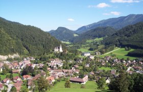
Details for: Sattelreith hiking trail
Brief description
Mostly on paved farm road
Description
From the community parking lot via the village square past Kalvarienberg, Treffenguthammer and Kranzlbauernmühle to the Steindl workshop. Now the path leads uphill to the left, past the Kothmühle and the farmhouses Groß- and Kleinkoth, from here it continues on a forest road to Sattelreith. Here the path joins Königsbergstraße and leads downhill to the left past the Sattel farmhouse to the trout pond. The descent back to the starting point is possible via Königsbergstraße. Or return the same way.
Starting point of the tour
Hollenstein community parking lot
Directions
Coming from Vienna, A1 to Amstetten West exit, via B121 to Waidhofen an der Ybbs, from there continue on B31 to Hollenstein an der Ybbs.
Coming from the west, A1 to Oed exit, via Aschbach Markt on B121, via B121 to Waidhofen an der Ybbs, from there continue on B31 to Hollenstein an der Ybbs.
Parking
Community parking lot
VOR bus line to Hollenstein town center
Author's tip
Swimming in one of the most beautiful river beach resorts on the Ybbs


