Details for: Willi-Gruber Way
Brief description
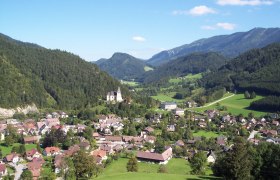
Easy walkable path with a view of the village and the church.
Description
Municipal car park - village square - old parsonage - Thomasberg goods road - shooting hut - Sagmeistersiedlung - Kalvarienberg - village square - municipal car park
Starting point of the tour
Municipal car park
Destination point of the tour
Municipal car park
Route description Willi-Gruber Way
From the municipal car park via the village square towards the church to the school. The path then leads along Königsbergstraße past the old parsonage to shortly after the Thomasberg junction. Here the trail leads uphill on the right past the shooting hut and enters Sagmeistersiedlung onto the municipal road from where it goes right again past Kalvarienberg back to the starting point.
Directions
Coming from Vienna take A1 to the Amstetten West exit, continue on B121 to Waidhofen an der Ybbs, then continue on B31 to Hollenstein an der Ybbs.
Coming from the west take A1 to the Oed exit, continue via Aschbach Markt on B121, then on B121 to Waidhofen an der Ybbs, then continue on B31 to Hollenstein an der Ybbs.
Parking
Municipal car park
VOR bus line to Hollenstein/Ybbs
Author's tip
Stop at the Schwarzlmüller bakery


