Details for: Main hiking trail "belebt.bewegt" in the hiking village Göstling/Ybbs
Brief description
A high plateau route through alpine mountain forests
From the hiking start point at the hiking host Bauernhof Ablass to the high moor, back and from there to the panoramic Sonnstein
Description
An original mountain experience in the nature reserve - a hike on three levels!
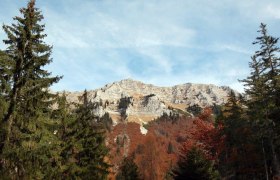
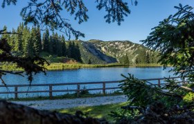
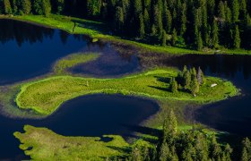
The hike starts at the high plateau of Hochreit at the hiking host Bauernhof Ablass and follows the hiking signposts towards the high moor via the Seisenbachau farm to the high valley. From there, the road continues to the impressive Hochmoor Leckermoos nature reserve, which is circled. Here on the second level, numerous natural special features can be seen and observed along the way. Surrounded by the original mountain forests, the route then leads back towards the hiking host Bauernhof & Jausenstation Ablass until about 350m before it a right turn is taken following the hiking signpost towards Sonnstein and Steinkogel. ATTENTION: If this summit variant is taken, absolute sure-footedness in the upper area is required! Because here the path leads up to Sonnstein at 1,019m, which represents the third and highest level. Alternately via forest roads and mountain paths, the way leads up to the summit. Once at the top, the panoramic view overwhelms and offers a special perspective of the surrounding mountain world (ATTENTION: sure-footedness is absolutely required in this area!). The descent initially follows the path through the forest and then continues via the forest road back to the starting point, the hiking host Bauernhof Ablass.
Starting point of the tour
Bauernhof Ablass
Destination point of the tour
Bauernhof Ablass
Route description Main hiking trail "belebt.bewegt" in the hiking village Göstling/Ybbs
Asphalt, secondary, forest roads and hiking trails
Directions
From Vienna take A1 to the Ybbs exit, then B25 to Göstling an der Ybbs
From Salzburg take A1 to Amstetten-West exit, then B121 towards Waidhofen an der Ybbs, and from there continue on L31 to Göstling an der Ybbs
Parking
Parking available at the hiking host Bauernhof & Jausenstation Ablass.
Author's tip
⛰️ TIP: SHORT HOLIDAY IN MOSTVIERTEL ⛰️
To get to know the hiking village Göstling/Ybbs, a short holiday is recommended. We are happy to assist you with the booking:
info@mostviertel.at
+43 7482 204 44

