Gipfelweg Hochkar

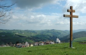
Hiking route from Hochkar, summit station to Hochkar Summit Cross

To view this content, you need to accept our Cookies. Change Cookie Settings
Full screen mode
Elevation profile

0,72 km length

Tour dates
  • Difficulty: Medium
  • Route: 0,72 km
  • Ascent: 53 egm
  • Descent: 17 egm
  • Duration: 0:15 h
  • Lowest point: 1.761 m
  • Highest point:1.807 m
Features
  • Nice views
  • With refreshment stops
  • Suitable for families and children
  • Summit tour

Details for: Gipfelweg Hochkar

Brief description

Short, easy hike with great views

Description

Particularly suitable for small children and older people. Few meters in altitude on a well-surfaced hiking trail to the summit and back. Impressive views of the Gesäuse and Alpine foothills along the entire route.

Starting point of the tour

Hochkar, summit station

Destination point of the tour

Hochkar Summit Cross

Route description Gipfelweg Hochkar

Starting from the Hochkarbahn summit station, head right along a well-maintained hiking trail through the Gr. Kar and across mountain pine fields up to the ridge, from where you can already catch a glimpse of the summit. In about 20 minutes, you’ll be able to count yourselves among the Hochkar summit conquerors and leave your mark in the summit logbook.

Author's tip

Do you love being out and about at high altitudes and enjoy athletic challenges? Then give the via ferrata at Hochkar a try!

More tours around the starting point