Schnabelbergtour
Mountainbike route from Waidhofen, Local Train Station
15,93 km length
- Difficulty: Difficult
- Route: 15,93 km
- Ascent: 560 egm
- Descent: 560 egm
- Duration: 1:00 h
- Lowest point: 358 m
- Highest point:918 m
- Round tour
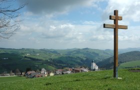
- Nice views
15,93 km length
Steep ascent to one of Waidhofen's local mountains with a cool descent.
Waidhofen – Hochpöchl – Falkengraben – Waidhofen
Starting point of the tourWaidhofen, Local Train Station
Coming from Vienna, take the A1 to the Amstetten West exit, then the B1/B121 to Waidhofen/Ybbs.
Coming from the west, take the A1 to the Oed exit, then drive through Aschbach Markt and take the B122 to the B121, then follow the B121 to Waidhofen/Ybbs.
Please note that additional MTB trails in the Mostviertel region are closed for the winterfrom November 1 through April 14.
Thank you for your understanding!
The climb isn't long, but it's very steep! Pace yourself.